Why are these tropical systems rare for the west coast? Here are a couple main reasons.
1. Tropical systems require very warm water: 74 degrees or greater down to 30-40 meters. The Alaskan Current is a cold-water current that typically flows southward down the Pacific coast... much different than the Gulf Stream which transports very warm water northward from the Gulf all the way to Iceland.
2. Wind shear is a storm killer... due to northerlies along the west coast, and the prevailing easterlies at lower latitudes, getting a setup which forces storms north is very difficult.
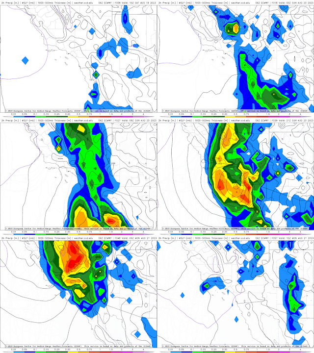
However, the setup is right this time around and we're watching Hilary closely as it moves northward. Baja California is already being affected by heavy rains, and the CONUS is sure to follow over the weekend. Areas of localized precipitation in excess of 14 inches are expected as tropical moisture is forced upward due to elevation. |
Hazards Expected
Flooding:
While much rain is needed in the southwestern US, torrential rains of this magnitude will flow downhill faster than they can be absorbed by the dry ground. The rain will surely help the water tables some, but for the most part widespread minor flooding and localized major flooding is possible as water flows downhill.
Due to the dry nature of the soil, I would expect trees, cacti, shrubs, and other foliage to be uprooted easily once water saturates the top layer of soil. Landslides will be a factor in Baja and So.Cal.
Winds:
Tropical storm force wind speeds are capable of snapping limbs and removing roof tiles and shingles. More extensive damage will be seen further south, but wind damage will still be something to be wary of in southern California.
Power Outages:
As I am unfamiliar with the west coast and how power transfer works out there (power lines, underground, insulated vs. uninsulated, etc.) I am unable to speak to how electricity may be affected in this area. However, typically tropical systems or organized storms of this magnitude can be associated with loss of power, especially in the event of flooding. Expect some power outages at least temporarily.
As always, stay tuned into your local weather forecasting offices and news stations for the most accurate and up-to-date analysis and information. Stay safe out there in this historic storm!


No comments:
Post a Comment